
A Toronto new build, captured at framing stage: 1.5 billion LiDAR points and a drone photogrammetry survey, reduced to an as-built Revit model — and a version light enough to open in a browser.
Most scan-to-BIM write-ups stop at "we scanned it and modelled it." The interesting part is everything in between — what a raw scan actually is, why you cannot hand it to a design team, and what survives the reduction to a usable model.
Here is one project end to end. A new residential building in Toronto, captured in July 2026 while the structure was still exposed, delivered as an as-built Revit model with DWG plans and elevations. All the numbers below are from that job.
What 1.5 billion points looks like
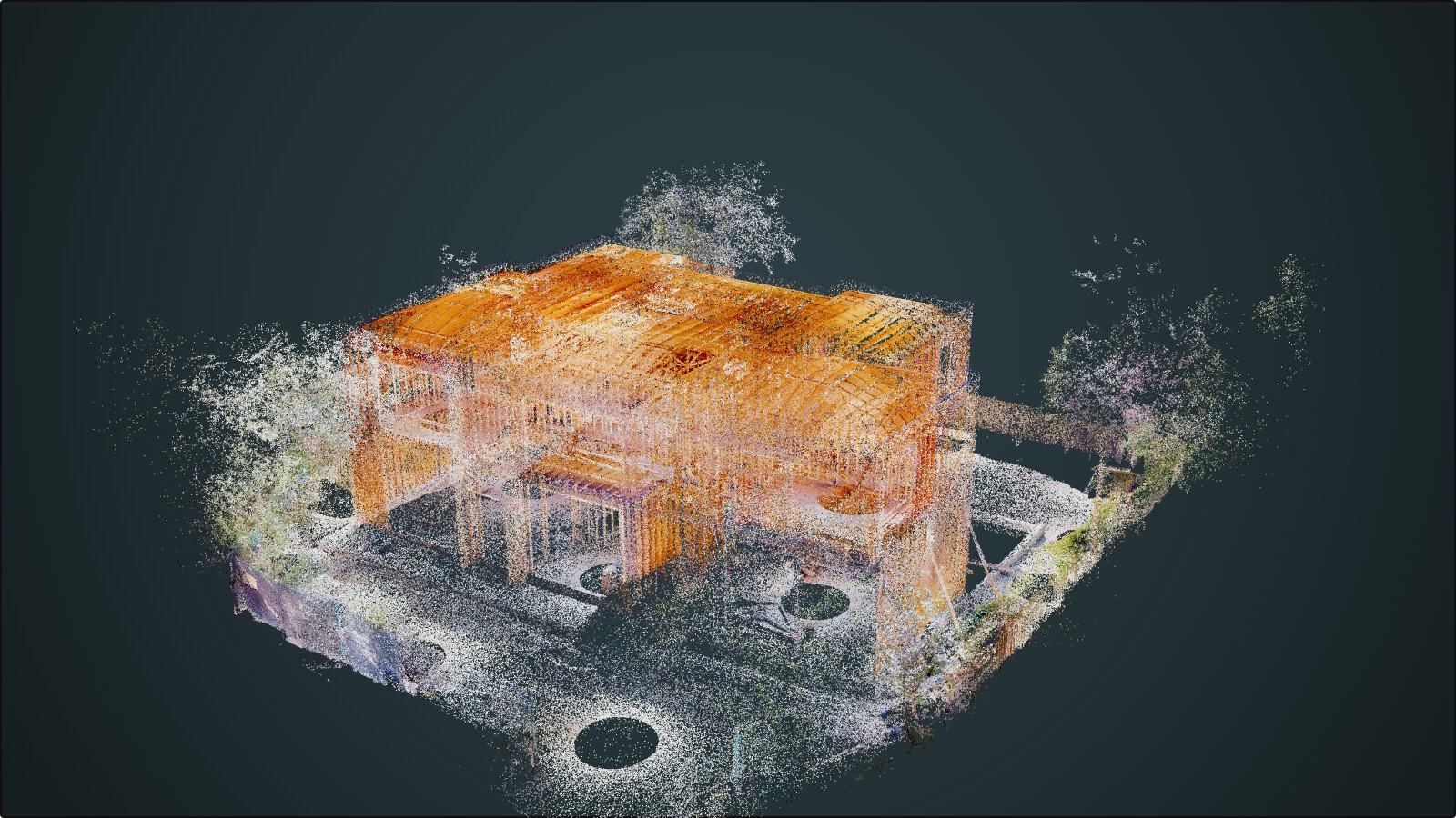
The terrestrial LiDAR survey returned 1,535,262,172 points across an 80 × 80 metre site. As a single LAS file, that is 37 GB. The registered ReCap scan alongside it is another 12 GB.
Those numbers are worth sitting with, because they explain the whole rest of the process. A 37 GB file is not something you email, open on a laptop, or hand to an architect. It is a measurement record, not a deliverable. Every step after capture is about turning that record into something a person can actually use — without throwing away the accuracy that justified the scan in the first place.
The scan carried full colour: LAS point format 2, with 16-bit RGB per point. That matters more than it sounds. A monochrome cloud is a geometry file. A coloured one is legible — you can see where a wall finish changes, where a service penetrates, where the timber is stained.
Why we flew it as well as scanned it
Terrestrial LiDAR is superb on vertical surfaces and interiors, and blind to the one part of a building it cannot see from the ground: the roof. So the site was also flown for photogrammetry.
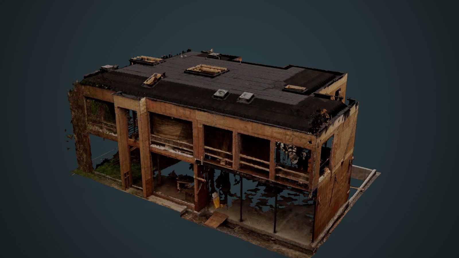
The two methods answer different questions. LiDAR gives the geometric backbone — the dimensional truth you measure against. Photogrammetry gives colour and texture continuity that makes the model readable to people who do not work in point clouds every day. Fused, you get a model that is accurate enough to take dimensions from and clear enough to put in front of a client.
The fused mesh came out at 1.98 million triangles over a 27.4 × 22.4 × 12.1 m envelope.
Capturing at framing stage was the whole point
The building was scanned before the finishes went on, and that timing is not incidental.
Buildings are rarely built exactly as drawn. Openings shift. Levels move. Services land a few centimetres off where the drawing set put them. None of these are failures — they are the normal accumulation of site decisions. But once drywall goes up, every one of them disappears from view, and every drawing produced afterwards quietly inherits assumptions nobody can check any more.
Scanning at framing stage records what was actually built, at the one point in the programme when it is still visible.
From cloud to Revit
The as-built model came out at 76 building elements across nine levels — 62 walls, three slabs, two columns, two structural members, two railings, and a stair with its flight, spanning basement through attic.
That count is deliberately modest, and it is worth being honest about why. Scan-to-BIM is not "convert the point cloud to a model." It is a judgement about what the client needs to be able to interrogate later. An envelope-and-structure model that is trustworthy beats an exhaustive one that is half-guessed. Every element in that model was placed against measured points.
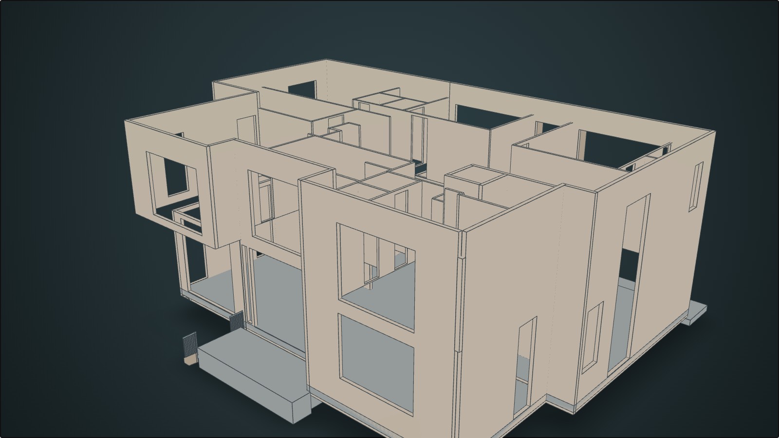
Delivered alongside it: floor plans for ground and second level, four elevations, and a 3D DWG, plus the registered point cloud itself for anyone who wants to go back to the source measurement.
Making it openable in a browser
This is the part most surveys skip, and the part clients notice most.
A Revit model is only useful to people who have Revit. The site manager, the client, the planner and the lawyer all have a legitimate reason to look at the building — and none of them are going to install a CAD package to do it.
So each deliverable was also processed into a browser-native version:
- The point cloud, thinned from 1.54 billion points to 2 million and compressed to 17.5 MB — enough to read the timber framing, the trees, and the site grading
- The photogrammetry mesh, reduced from 1.98 million triangles to a 989,000-triangle web build at 4.9 MB
- The Revit model, exported via IFC and converted to 0.2 MB of geometry with edge line-work drawn in so the wall planes read clearly
None of these replace the working files. They are the version you can send in a link.
See it yourself
All three deliverables are on the project page, in one viewer, with a shared camera — so you can switch between the photogrammetry mesh, the LiDAR cloud and the BIM model and see the same building three ways.
Explore the as-built survey project →
That progression is the honest version of what scan-to-BIM is. Not a model that appeared from nowhere, but a chain you can inspect: measured reality, reduced deliberately, into something a design team can build on.
Have a building that needs measuring before the finishes go on? Request a quote.