

As-Built 3D Survey — New Build, Toronto
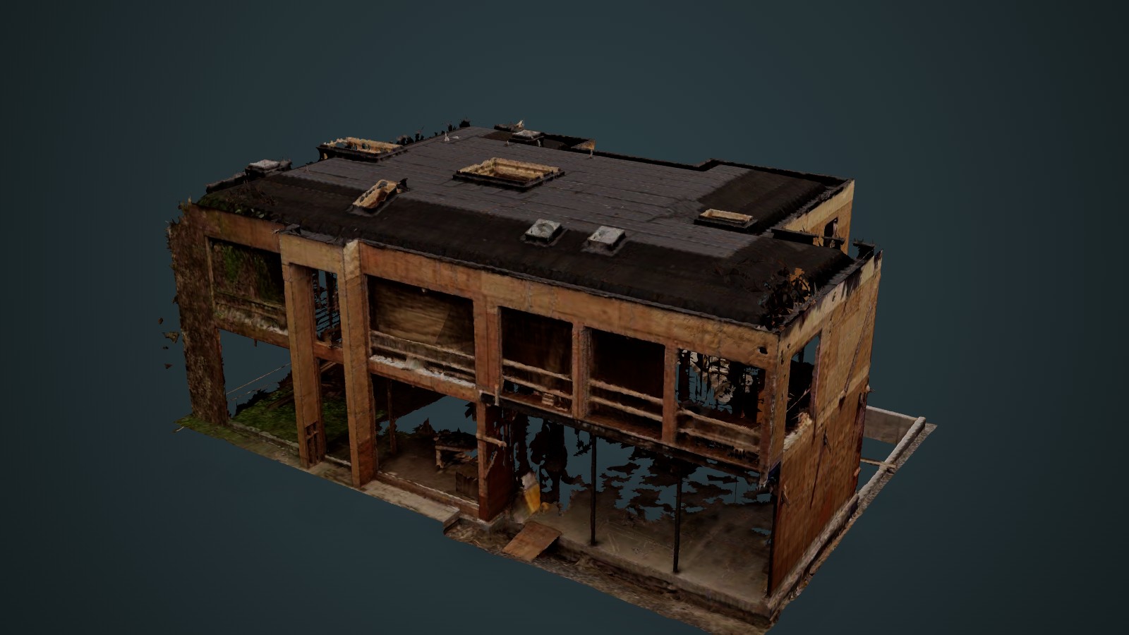
5 MB model · loads on request
- AZ
- —
- EL
- —
- RANGE
- —
drag to orbit · scroll to zoom
two fingers to pan · arrow keys to step
Project Overview
A new building in Toronto, captured in July 2026 while the structure was still exposed and reconstructed as a single measurable 3D model you can explore in the browser above. Drone photogrammetry and LiDAR were fused into one continuous mesh covering a 27.4 × 22.4 × 12.1 m envelope. The delivered mesh runs to 1.98 million triangles; the version embedded above is a 989 K web build of it — still enough resolution to read structural framing, slab edges, opening positions, and roof penetrations directly off the model.
From Scan to BIM
The three tabs above are the actual deliverables, in the order they were produced. 3D Realistic is the photogrammetry reconstruction — the version that reads instantly to anyone, technical or not. Cloud is the LiDAR survey itself: 1.54 billion measured points across an 80 m site, thinned to 2 million for the browser, and the layer everything dimensional is derived from. BIM is the Revit as-built model built from that scan, which is what actually lands in the design team's hands alongside floor plans and elevations in DWG.
Most firms show you the last one. Being able to move between all three in the same window is the point — you can see what the model was measured against instead of taking it on trust.
Why Capture As-Built
Buildings are rarely built exactly as drawn. Openings shift, levels move, services land a few centimetres off where the drawing set put them. Once the finishes go on, those deviations disappear from view — and every drawing produced afterwards quietly inherits them. Capturing the structure while it is still exposed records what was actually built, at the one point in the programme when it is still visible.
Capture & Processing
Photogrammetry supplies the colour and texture that make the model legible to everyone on the project, not just the technical team; LiDAR supplies the geometric backbone that keeps it dimensionally trustworthy. Fusing the two produces a model that is accurate enough to measure against and clear enough to present. Processing then reduces the survey-grade result into web-deliverable form, so the same capture that feeds the drawing set also works as a shared reference anyone can open.
What We Delivered
The as-built Revit model, floor plans and elevations as DWG, the registered point cloud, and the full-resolution textured mesh — plus the compressed browser-native versions embedded on this page. The design team works against measured reality rather than design intent, and anyone with a link can orbit the building, switch to a plan view, and check a condition for themselves — without a site visit, a CAD licence, or a question routed through the one person who has both.