

Foundation Scan-to-BIM — Forest Hill South, Toronto
28 MB scan + 3D model · loads on request
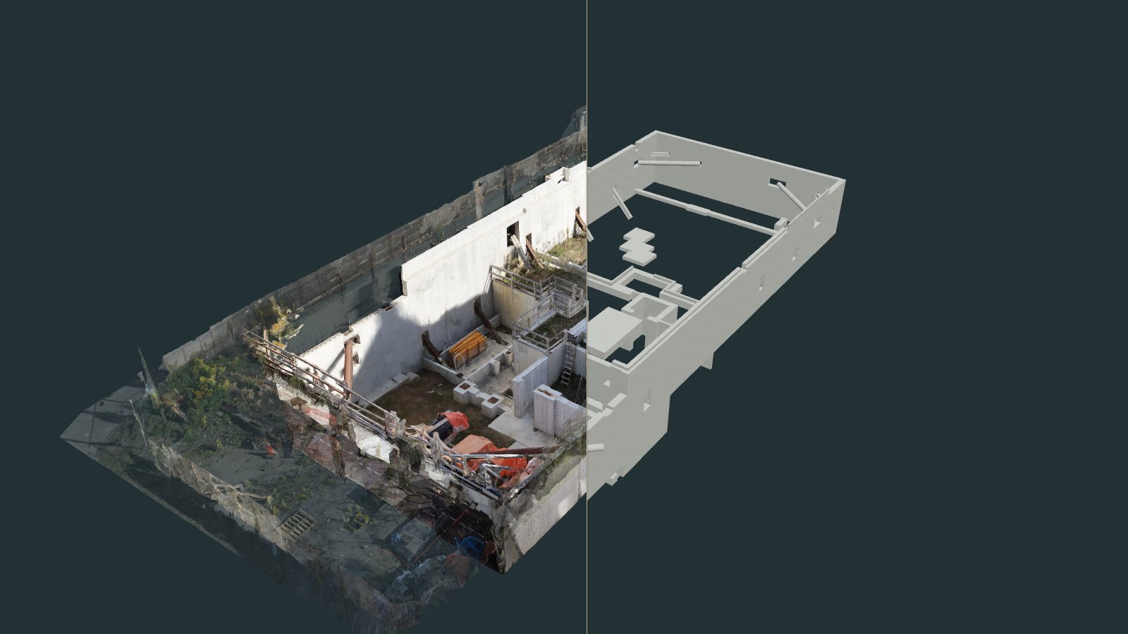
Compare slides between the captured site and the 3D model. 3D Realistic, Cloud and BIM show each deliverable on its own, from the same viewpoint.
Project Overview
A new house foundation in Forest Hill South, Toronto, captured in October 2026 while the excavation was still open: the concrete walls poured, the steel rakers still bracing them, and nothing yet backfilled. A terrestrial laser scan and a drone flight were fused into a single textured 3D model of the site. The 3D foundation model was then placed alongside it, so the two can be compared in the browser above.
Why Scan a Foundation Before Backfill
A foundation is only fully visible for a few weeks. Once the backfill goes in, wall positions, openings, sleeves and the shoring that held the excavation open are buried, and every later question about them becomes a question about the drawings. Capturing the open excavation keeps a permanent, explorable record of what was actually built below grade, at the one moment it can still be seen.
Capture & Processing
The excavation was scanned from 24 terrestrial LiDAR stations, which supply the geometry. Two drone flights, one looking straight down and one at an oblique angle, supply the colour and the views into the pit that a tripod at grade cannot reach. Both were fused into a georeferenced textured mesh of 12.3 million faces. The version embedded above is a 1.68-million-triangle web build of it, sized so the comparison runs on an ordinary laptop or phone.
Four Views of One Site
The tabs above are the deliverables, and every one of them shares the same camera, so switching keeps you looking at the same wall. 3D Realistic is the textured reconstruction — the version that reads instantly to anyone on the project. Cloud is the same capture as points: 1.6 million of the 6.1 million in the fused LiDAR and drone model, thinned for the browser. It is not the raw scanner output, which runs to tens of gigabytes and is delivered separately. BIM is the 3D foundation model — its walls, the steel shoring members and the internal structure, shown in plain concrete grey.
Compare puts the captured site and the 3D model either side of a divider you can drag across the excavation. Ground beyond the foundation footprint is dimmed to keep attention on the structure; the Context button hides it entirely. The scan has been fitted to the model by eye for this presentation, so treat the overlay as a visual comparison rather than a measurement. Dimensional checks are made against the registered point cloud, not this web view.
What We Delivered
The registered point cloud in E57 and ReCap formats, the full-resolution textured mesh, a georeferenced model in UTM zone 17N, and the 3D foundation model — plus the browser comparison on this page. Anyone on the project can open it from a link, orbit the excavation, switch to a plan or elevation view and check a wall against the model, without a site visit or a desktop licence.