
// Solution
Pre-Backfill Foundation Record
We scan the foundation in the days before backfill and hand back a dated 3D record of what went into the ground — walls, waterproofing, drainage, sleeves and the shoring that held the dig open — as a private link anyone on the project can open, with the survey data behind it.
Who it’s for
Builders and general contractors on custom homes, infill and small buildings — and the owners, architects and engineers who will need to know what is below grade later.
A foundation is fully visible for a few weeks. Ontario’s building code already asks for an inspection notice once footings and foundations are complete and before backfill, so there is a natural window when the work is finished and still open. After it closes, every question about a drain run, a sleeve, a membrane lap or a wall position goes back to the drawings — or to an excavator.
We book the capture for that window. What you get back is not a folder of site photos but the whole excavation in 3D, dated, in a viewer that opens on a phone, with the items that matter pinned and labelled.
The record keeps paying after the job. It is the reference for a renovation, a pool or a new service connection years later; a dated baseline if a defect, a neighbour complaint or an insurance claim ever turns on what was built; and part of the house file when the property changes hands.
Scope and what you get
Pre-Backfill Foundation Record
Fixed scope, fixed price. Additional visits — excavation, footings, close-in — are quoted on the same terms.
- Scale
- One foundation — a house, an addition or a small building
- Timeline
- Capture booked into the days before backfill; delivery date confirmed when you book
- Pricing
- Fixed quote after a scoping call
- You provide
- Site access with the excavation open, and the foundation drawings or design model if you want them compared
Deliverables
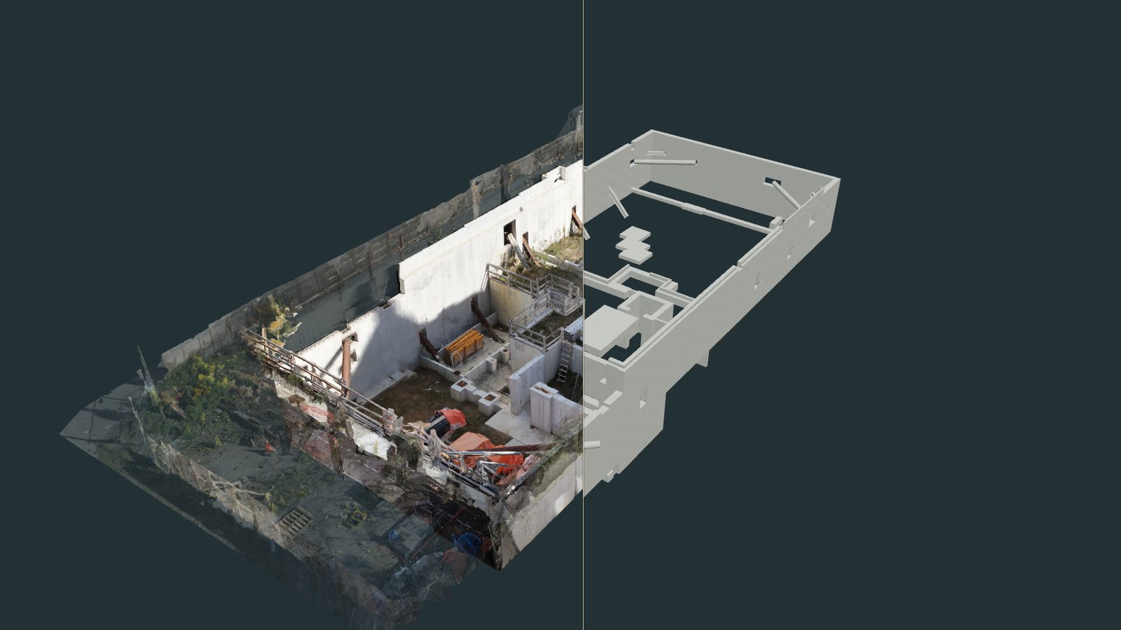
- Private 3D viewer link: textured model, point cloud and 3D model, side by side on one camera
- Numbered notes pinned to the items that matter — drains, sleeves, waterproofing, shoring
- Registered point cloud (E57) — the measurement record
- 3D model of the foundation, in IFC or your own format on request
- Dated record sheet (PDF) with plan, elevation and close-up views
- Optional: scan compared against the design model, for your engineer to review
- Data archived for an agreed term, so the record outlives the project folder
Method
Two captures, because neither sees everything on its own. A terrestrial laser scanner, set up at stations around and inside the excavation, supplies the geometry. A drone flown straight down and at an angle supplies the colour, and the views into the pit that a tripod at grade cannot reach.
The two are fused into a single georeferenced model and a registered point cloud. From those we build the 3D foundation model and a web version of all three, sized to open on an ordinary laptop or phone. Anything worth finding again — a sleeve, a drain outlet, a raker — gets a numbered note in the viewer.
The browser view is for seeing and sharing. Dimensions come from the registered point cloud, and where a check has to be binding, the call stays with your engineer or surveyor — we give them the data to make it.
See the result on a real site in Foundation Scan-to-BIM — Forest Hill South. The capture runs on our 3D Mapping & Reality Capture service and the model on BIM & Digital Twins.
Tell us when the backfill is booked.
Send the site, the expected backfill date and the drawings if you have them, and we will come back with a capture date and a price.